
Storm Events Database: Unlocking 1.9 Million US Severe Weather Events from 1950-Present
How we transformed nearly two million NOAA storm records into a discoverable platform for decision-makers nationwide

Project Takeaways
Storm Events made searchable and discoverable
Years of historical weather data
Counties covered across all 50 states & major territories
Use cases for decision makers
The Storm Events Database represents exactly what federal open data should be—comprehensive, rigorous, and invaluable for protecting American lives and livelihoods. But for too long, this essential dataset has been trapped behind technical barriers that prevent most users from accessing its full potential. This platform doesn't just make the data easier to find; it demonstrates why continued investment in NOAA's data collection is critical for building climate resilience across every community in America.

Project Deployment Strategy
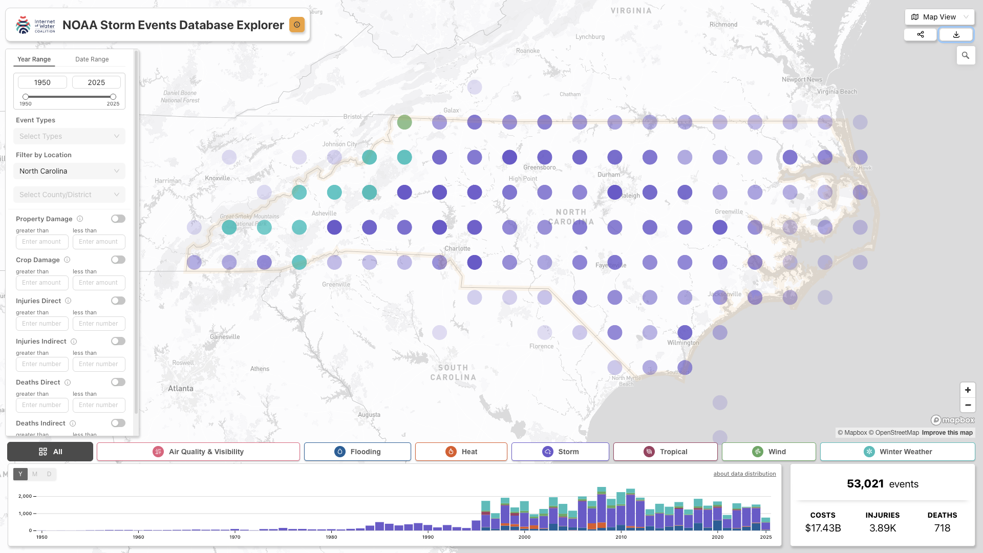
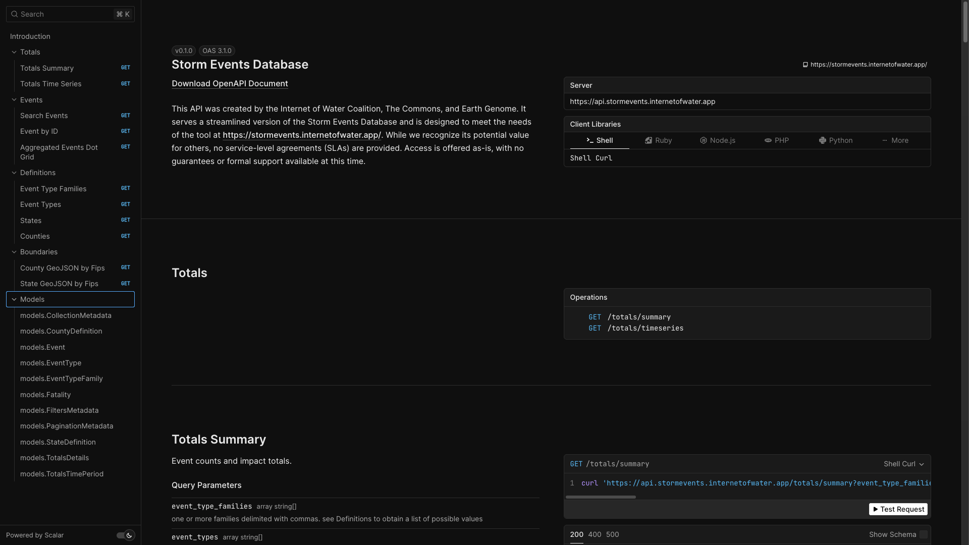
Working in partnership with the Internet of Water and Earth Genome, The Commons developed a comprehensive web mapping platform that transforms NOAA's Storm Events Database from an unwieldy collection of CSV files into an intuitive, searchable resource for critical decision-making. The platform addresses fundamental accessibility barriers that have long prevented widespread adoption of this essential federal dataset, creating a dynamic interface that serves insurance agencies, emergency planners, researchers, and community leaders who rely on historical storm data to protect lives and economic assets. The fully responsive system demonstrates the transformative potential of thoughtful data product design, establishing a replicable model for making complex federal datasets accessible to the communities that need them most.

React
Core JavaScript framework for SED's front-end interface.

Mapbox GL JS
Supports all interactive mapping features.

PostgreSQL
Database for storing all storm data, with the PostGIS extension for advanced geospatial queries. We relied on pg_tileserv to dynamically generate map tiling layers directly from our database and Go to write and deliver a high-performance API

AWS
The entire platform is hosted on a modern, scalable cloud infrastructure including Docker, AWS Fargate, and Source Cooperative
Project and Environmental Policy Intersection
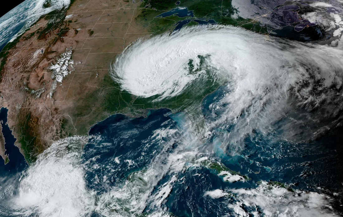
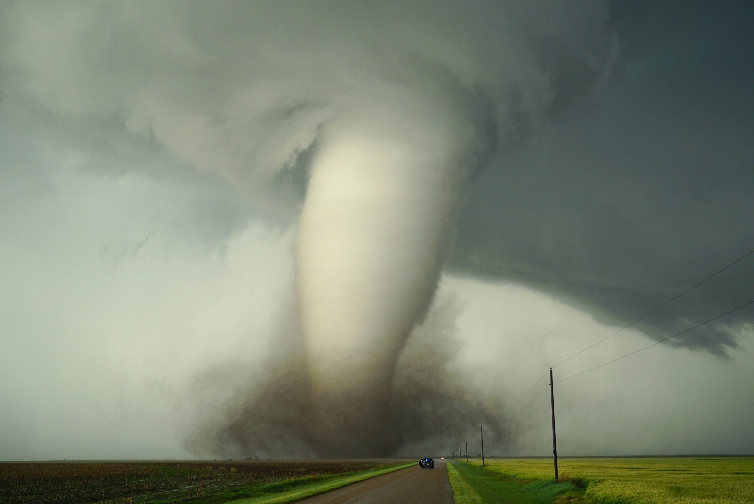
The National Oceanic and Atmospheric Administration's Storm Events Database represents one of the most comprehensive and rigorous collections of severe weather data in the world, documenting nearly two million individual storm events across more than 50 years of American weather history. This essential dataset captures detailed information about hurricanes, tornadoes, floods, hail, and dozens of other severe weather phenomena, providing an unparalleled record of how extreme weather events impact communities, infrastructure, and economic systems across all 50 states. Each record includes geographic coordinates, monetary damage estimates, casualty reports, and narrative descriptions that collectively form an irreplaceable foundation for understanding weather-related risks and building climate resilience.
Despite its extraordinary value, the Storm Events Database has remained largely underutilized due to significant accessibility barriers that prevent most potential users from accessing its insights. NOAA currently distributes the data through a complex FTP system that requires technical expertise to navigate, with files organized in formats that demand substantial preprocessing before analysis can begin. Users must manually download dozens of separate CSV files, understand intricate data schemas, resolve inconsistencies across different time periods, and invest considerable technical resources to transform raw records into actionable information. This technical complexity has effectively limited access to a small community of specialists, preventing the broad adoption that would maximize the dataset's public benefit.
The accessibility challenge is particularly acute given the critical decision-making contexts where Storm Events Data could provide essential insights. Insurance companies need historical storm patterns to assess risk and price policies accurately, but current access barriers often force reliance on incomplete commercial datasets. Emergency management planners require detailed local storm histories to develop effective mitigation strategies and allocate resources appropriately, yet technical constraints limit their ability to analyze relevant patterns. Academic researchers studying climate change impacts need comprehensive baseline data to identify trends and project future risks, but data processing requirements often exceed available technical capacity. Community leaders and policy makers need accessible information about local weather risks to make informed infrastructure investments and zoning decisions, yet the current system provides no pathway for non-technical users to explore relevant historical patterns.
This situation represents a fundamental disconnect between the substantial public investment in weather data collection and the limited public benefit realized through restricted access. NOAA's National Centers for Environmental Information has maintained rigorous data collection standards for decades, creating an invaluable public resource that documents the changing nature of severe weather across American communities. However, the gap between data collection and practical application has prevented this investment from achieving its full potential impact on public safety, economic resilience, and climate preparedness. The need for improved accessibility has become increasingly urgent as climate change intensifies extreme weather patterns and communities nationwide face growing pressure to understand and prepare for evolving risks.
Project Planning
The Storm Events Database accessibility challenge stemmed from a fundamental mismatch between the high value of NOAA's comprehensive weather data and the technical barriers that prevented most potential users from accessing its insights. Despite containing nearly two million meticulously documented storm events spanning seven decades of American weather history, the dataset remained largely confined to technical specialists due to complex FTP distribution systems, inconsistent file formats, and the substantial preprocessing required to transform raw data into analysis-ready formats. Insurance agencies, emergency planners, researchers, and community leaders who could benefit enormously from historical storm patterns were effectively excluded from accessing this essential public resource, creating a critical gap between data collection investments and real-world decision-making applications.
Working directly with Internet of Water and Earth Genome project stakeholders, our team conducted comprehensive user research to understand the diverse needs of potential Storm Events Database users across multiple decision-making contexts. Through this collaborative process, we identified five core requirements that would need to be addressed for a modernized Storm Events platform. First, the system needed an intuitive geographic interface that would allow users to quickly explore storm patterns by location, time period, and event type without requiring technical expertise in data processing or GIS analysis. Second, comprehensive search and filtering capabilities were essential to enable users to identify specific storm events, compare patterns across different regions or time periods, and extract relevant subsets of the larger dataset for detailed analysis.
Third, the platform required robust data visualization tools that could transform complex tabular records into accessible maps, charts, and summaries that would enable rapid pattern recognition and insight generation for non-technical users. Fourth, programmatic access through modern APIs was necessary to support advanced users and enable integration with other applications, ensuring the platform could serve both browsing and analytical use cases. Finally, comprehensive documentation and educational resources were needed to help users understand data limitations, methodology changes over time, and appropriate applications for different types of analysis.
To meet these requirements, The Commons developed a strategic approach that prioritized user experience while maintaining the scientific rigor and completeness of the original NOAA dataset. We conducted extensive analysis of the raw Storm Events data to understand its structure, identify quality issues, and develop processing workflows that would preserve data integrity while improving accessibility. Our technical approach focused on creating a responsive web platform that could handle complex geographic queries across millions of records while providing immediate visual feedback to help users understand search results and identify relevant patterns.
Methodology
The core methodology centered on transforming NOAA's Storm Events Database from a collection of technical files into a comprehensive data product that could serve diverse user communities while demonstrating the broader potential of federal open data initiatives. Our approach prioritized sustainable infrastructure, intuitive user experience, and extensible architecture to ensure the platform could evolve alongside changing user needs and technological capabilities. The Storm Events platform delivers the following capabilities:
- Dynamic geographic interface enabling exploration of storm patterns across all 50 states with interactive mapping and zoom capabilities
- Advanced filtering system supporting searches by event type, date range, damage thresholds, geographic boundaries, and multiple other criteria
- Comprehensive data visualization including event categorization, damage summaries, and filtering that unlocks fast, comparative regional analysis
- Mobile-responsive design ensuring accessibility across all device types for field-based emergency planners and community stakeholders
- RESTful API access enabling programmatic data retrieval for advanced applications and integration with existing decision-support systems
- Educational resources providing context about data collection methods, limitations, and appropriate analytical applications
- Export capabilities allowing users to download filtered datasets in multiple formats for further analysis
Our data processing methodology began with comprehensive analysis of the raw Storm Events Database to understand its evolution over five decades of collection. We developed automated workflows to standardize geographic coordinates, resolve inconsistencies in event categorization across different time periods, and create unified schemas that maintained backward compatibility while improving data quality. This processing approach preserved the scientific integrity of the original dataset while addressing technical barriers that had previously prevented widespread adoption.
We implemented a distributed architecture that separates data processing, API services, and user interface components to ensure system scalability and maintainability. This approach enables independent updates to different platform elements while maintaining stable service for end users, supporting both current functionality and future enhancements as user needs evolve. The backend infrastructure efficiently handles complex geographic queries across millions of records while providing sub-second response times for interactive mapping and filtering operations.
Our user experience methodology emphasized progressive disclosure, allowing casual users to quickly explore high-level patterns while providing pathways for detailed analysis when needed. We conducted iterative testing with representatives from insurance, emergency management, and research communities to ensure the interface met diverse professional requirements while remaining accessible to community stakeholders and policy makers. This user-centered approach resulted in an interface that balances simplicity for occasional users with sophisticated functionality for power users.
Throughout the development process, we prioritized comprehensive documentation that explains both technical implementation details and broader strategic considerations for federal data accessibility. Our documentation approach recognizes that successful data products require ongoing maintenance and evolution, providing future developers and stakeholders with the institutional knowledge needed to sustain and enhance the platform over time.
Results and Outcomes
The Storm Events Database platform represents a significant advance in federal data accessibility, demonstrating how thoughtful product design can unlock the full potential of essential government datasets while strengthening the case for continued public investment in data collection and stewardship. This comprehensive digital infrastructure has successfully transformed nearly two million NOAA storm records from an underutilized technical resource into an accessible tool that serves critical decision-making across insurance, emergency management, research, and policy communities. The platform establishes a replicable model for federal data modernization that balances public access with scientific rigor, creating sustainable pathways for broader adoption of essential government datasets.
Establishing a Foundation for Data-Driven Climate Resilience
The primary achievement of the Storm Events platform lies in its demonstration that federal weather data can serve as a cornerstone for building climate resilience across American communities when made accessible through appropriate technological infrastructure. By enabling insurance agencies to access comprehensive historical storm patterns for accurate risk assessment, supporting emergency planners in developing evidence-based mitigation strategies, and providing researchers with streamlined access to decades of weather observations, the platform creates new pathways for translating government data investments into tangible public benefits. This comprehensive accessibility represents a fundamental shift from data as a technical resource to data as a public infrastructure that directly supports community safety and economic resilience.
The platform's geographic interface has proven particularly valuable in connecting national-scale data collection to local decision-making needs, enabling community leaders to understand their specific weather risks within broader regional and historical contexts. This localized approach bridges the critical gap between federal data collection and municipal planning, creating opportunities for more informed infrastructure investments, zoning decisions, and emergency preparedness strategies that reflect actual historical weather patterns rather than general assumptions about regional climate.
Demonstrating the Strategic Value of Federal Open Data
At a time when federal open data initiatives face unprecedented scrutiny, the Storm Events platform provides compelling evidence that government datasets represent essential infrastructure for American economic competitiveness and public safety. By showcasing the practical applications of NOAA's data collection investments across multiple decision-making contexts, the platform strengthens the case for continued federal support of comprehensive weather monitoring and data stewardship. The success of this approach demonstrates that the value of government data extends far beyond immediate scientific applications, creating ripple effects across insurance markets, emergency management systems, and community planning processes that collectively protect American lives and economic assets.
The platform has worked to align with broader federal data ecosystem initiatives, including partnerships with EssentialData.US and source.coop, establishing a collaborative framework for maximizing the impact of government data investments. This ecosystem approach recognizes that individual datasets achieve their greatest value when connected to complementary resources and presented through user-centered interfaces that reflect actual decision-making workflows rather than technical convenience.
Creating Sustainable Infrastructure for Ongoing Innovation
The Storm Events platform's modular architecture and comprehensive documentation create a foundation for ongoing enhancement and adaptation as user needs evolve and new data sources become available. By building the system around modern web standards and API-first principles, the platform enables integration with existing decision-support systems while supporting development of new applications that can leverage Storm Events data alongside other relevant datasets. This extensible approach ensures that the platform can grow with changing technological capabilities and user requirements while maintaining stable service for current applications.
The project's emphasis on comprehensive documentation and knowledge transfer creates institutional sustainability that protects public investment in data accessibility infrastructure. By documenting both technical implementation details and strategic decision-making processes, the platform establishes a replicable framework that can inform similar federal data modernization efforts while ensuring that critical system knowledge remains accessible to future maintainers and enhancers.
Through demonstrating the transformative potential of thoughtful data product design, the Storm Events Database platform establishes new standards for federal data accessibility that balance public benefit with scientific integrity, creating sustainable pathways for maximizing the value of essential government datasets in support of American climate resilience and economic competitiveness.
Support the Digital Services Program
.svg)

.svg)