Precision Conservation Tracking at Scale
How FieldDoc connected strategic conservation targeting with verifiable on-the-ground implementation across Virginia’s longest river

Project Takeaways
In grants awarded
Conservation practices deployed
Lbs Nitrogen Reduced/Yr
Tons Sediment Reduced/Yr
"Field Doc is for the Virginia Environmental Endowment an invaluable tool for tracking on-the-ground implementation, from a project level perspective as well as a programmatic perspective. It is an accountability tool for us as well as our grantees, providing easily accessible and usable data and analysis for understanding where the hundreds of restoration efforts fall within the big picture of an entire rivershed restoration initiative. All of this is only possible because The Commons has created a tool and provided the staff that make the use of Field Doc easily accessible and always responsive."

Project Deployment Strategy
Working in partnership with the Virginia Environmental Endowment (VEE), The Commons developed the implementation tracking infrastructure for the James River Water Quality Improvement Program (JRWQIP), a landmark $15.595 million grant initiative designed to accelerate water quality restoration across the James River watershed. The FieldDoc platform provides the critical practice-level tracking system that captures each conservation intervention deployed by VEE grantees—from riparian buffers and agricultural best management practices to living shorelines and stream restorations—with precise spatial accuracy and automated pollutant load reduction modeling. By linking each spatially-explicit restoration activity tracked in FieldDoc to its corresponding tier-ranked parcel, the program creates a comprehensive, verifiable record that validates whether grant-funded projects are landing in the highest-priority locations—closing the loop between strategic planning and on-the-ground implementation.

FieldDoc | Conservation Tracking
Practice-level conservation tracking, geospatial mapping, and automated nutrient/sediment load reduction modeling

ArcGIS Online | Parcel Suitability
Precision conservation targeting using high-resolution land cover and flow path data to rank every parcel by restoration opportunity (Tier 1–5)

Felt | Data Dissemination and Visualization
Integrated FieldDoc conservation practice data to enable rich summary statistics and optimized parcel rendering at scale.
Project and Environmental Policy Intersection
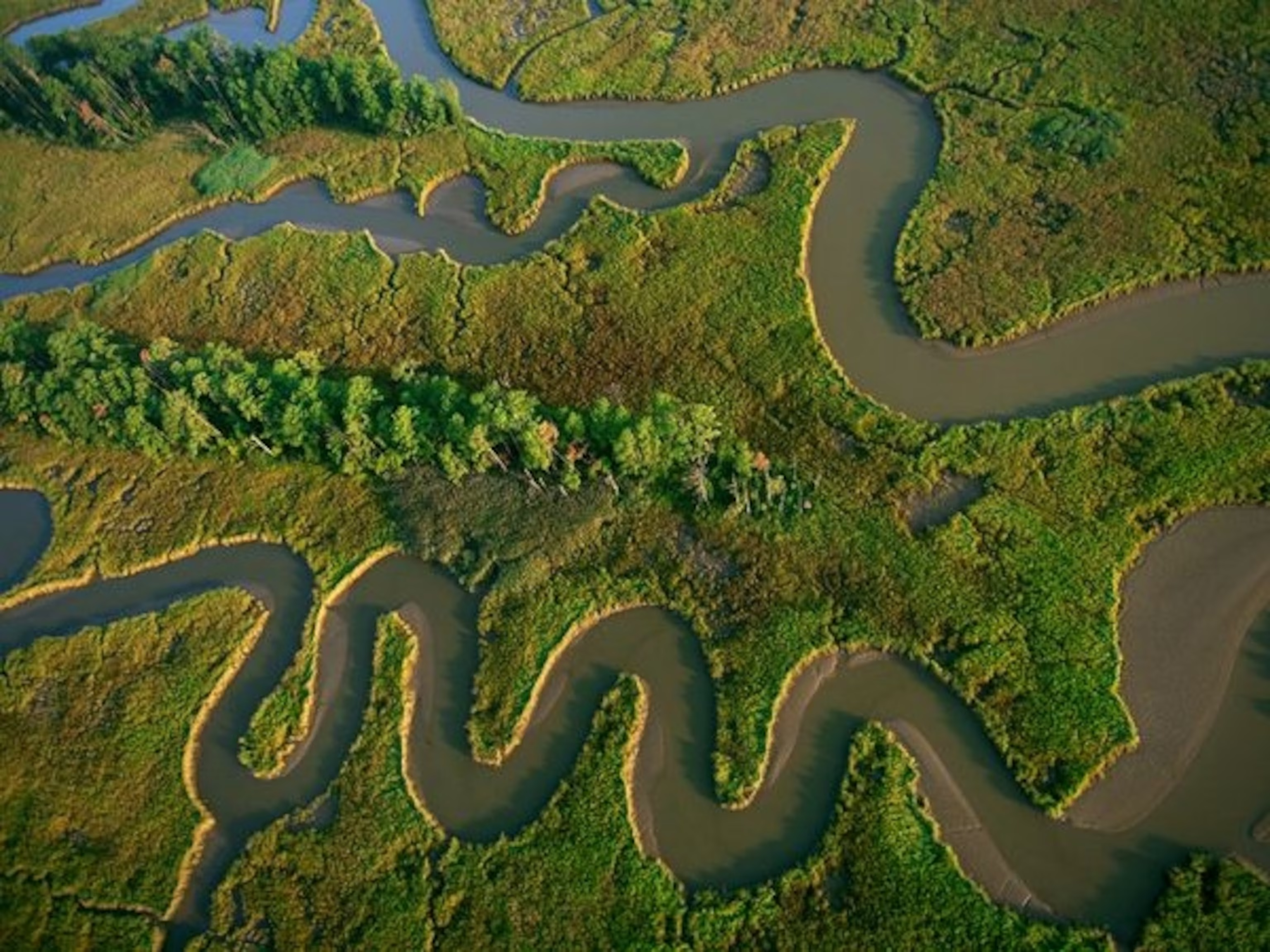
The James River, Virginia’s largest tributary to the Chesapeake Bay, stretches nearly 350 miles from the Appalachian Mountains to Hampton Roads, flowing through a diversity of habitats, industries, and communities. While the river has made remarkable improvements over the past 40 years—a testament to the Clean Water Act, the Chesapeake Bay Total Maximum Daily Load (TMDL), and decades of state and local restoration efforts—significant pollution reductions remain necessary to fully restore the river and meet the goals of the Chesapeake Bay Watershed Agreement.
The Virginia Environmental Endowment was established in 1977 from a federal court fine imposed on Allied Chemical Corporation for polluting the James River with the pesticide Kepone—one of the most significant environmental contamination events in American history. In 2017, VEE received $15.595 million under a mitigation agreement governing the Surry-Skiffes electrical power line river crossing near Jamestown, creating the James River Water Quality Improvement Program. The JRWQIP represents one of the largest private investments in James River water quality, and VEE recognized from the outset that this scale of funding demanded a rigorous, data-driven approach to ensure every dollar produced maximum environmental benefit.

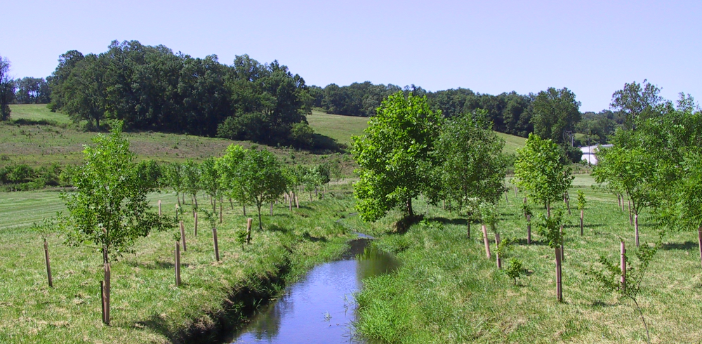
The JRWQIP’s strategic investment priorities align directly with the pollutant reduction strategies identified in Virginia’s Chesapeake Bay TMDL Phase III Watershed Implementation Plan: riparian buffer installation on agricultural and rural lands, accelerating implementation of agricultural best management practices with enhanced technical assistance, construction of living shorelines in the Lower James, and stream restoration with floodplain reconnection. In the Jamestown region, the program also targets illicit sewage discharges and failing septic systems. These priorities reflect the specific sources of nitrogen, phosphorus, and sediment loading that continue to impair water quality in the James River watershed and contribute to the broader degradation of the Chesapeake Bay.
To ensure these investments achieved their intended impact, VEE established a first-of-its-kind integration between precision conservation planning and practice-level implementation tracking—combining the Chesapeake Conservancy’s Restoration Planner for site selection with The Commons’ FieldDoc platform for verifiable outcome measurement. This approach created a closed-loop system where high-resolution spatial data informed investment decisions, and granular implementation data validated whether those investments were deployed where they would deliver the greatest water quality returns.
Project Planning
The fundamental challenge facing the JRWQIP was one of scale and accountability: how does a private funder distribute $15.595 million across a 10,000+ square mile watershed—spanning agricultural, suburban, and tidal landscapes—while ensuring that every grant-funded conservation practice lands in the location where it will generate the greatest pollution reduction? Traditional grant management approaches relied on narrative reporting and aggregate statistics that could not answer the spatial question at the heart of conservation effectiveness: are we putting the right practices in the right places?
VEE’s program officers recognized that answering this question required two complementary technical capabilities. First, they needed a targeting framework that could systematically evaluate every parcel in the James River watershed and rank them by restoration opportunity. Second, they needed a tracking system that could capture the precise location, dimensions, and specifications of every conservation practice installed by grantees—and calculate the resulting pollutant reductions using scientifically validated models. Only by linking these two systems could VEE verify that grant-funded implementation aligned with program targeting priorities.

The Chesapeake Conservancy’s Conservation Innovation Center addressed the first need by developing the Restoration Planner, a web-based application leveraging 1-meter resolution land cover data, high-resolution flow path analysis, and soil loss modeling to identify and rank restoration opportunity areas across the entire James River watershed. The Restoration Planner analyzes every parcel and assigns it a tier ranking from 1 (highest conservation opportunity) to 5 (lowest), based on weighted attributes including land cover composition, soil loss potential within the drainage area, and proximity to impaired waterways. This five-tier prioritization system gave VEE and its grant applicants a shared, data-driven framework for identifying where investments would produce the greatest water quality benefits.

The Commons’ FieldDoc platform addressed the second need by providing the practice-level tracking infrastructure that captures each conservation intervention at sub-parcel scale. As grantees implement practices across the watershed, FieldDoc documents the exact location and extent of each installation using geospatial drawing tools, records implementation details that verify design specifications, and automatically calculates pollutant load reductions based on Chesapeake Bay Program-approved methodologies. Critically, because FieldDoc captures the spatial footprint of every practice, each installation can be overlaid onto the Restoration Planner’s tier-ranked parcels—enabling VEE to assess how well grant-funded implementation aligns with program targeting priorities. Aggregating practice extents across all activity types, the data reveals that over 77% of total implementation occurred on Tier 1 parcels, with 95% concentrated in Tier 1 and Tier 2 parcels combined—a powerful validation that the Restoration Planner’s prioritization is translating directly into strategic placement on the ground.
Methodology
The core innovation of this project lies in connecting two distinct but complementary spatial data systems—conservation targeting and implementation tracking—into a unified accountability framework. Our methodology centered on deploying FieldDoc as the operational backbone for all JRWQIP grantee reporting, while establishing the data architecture needed to validate implementation against the Restoration Planner’s parcel-level prioritization. The FieldDoc deployment for JRWQIP encompasses the following capabilities:
- Geospatial practice delineation allowing grantees to map the precise boundaries of each conservation installation using point, line, or polygon geometries
- Curated VEE-approved practice type library covering riparian buffers, agricultural BMPs, stream restorations, living shorelines, stormwater management installations, and Jamestown-region interventions
- Automated pollutant load reduction modeling using the Chesapeake Bay Watershed Model’s Adapted Nutrient and Sediment Load Reduction algorithms for total nitrogen, total phosphorus, and total suspended solids
- Programmatic metric tracking enabling grantees to report progress on supplementary targets such as trees planted, miles of fence constructed, and acres of buffer established
- Program-level dashboards aggregating individual practice and project data into watershed-scale impact metrics for VEE program officers
- Spatial overlay analysis linking each FieldDoc-tracked practice footprint to its corresponding Restoration Planner tier-ranked parcel for implementation validation
- Public-facing data visualization through an embedded FieldDoc-powered dashboard within the program’s ArcGIS StoryMap, allowing stakeholders to explore project locations and impact metrics interactively

From Planning to Tracking: Closing the Conservation Accountability Loop
The relationship between the Restoration Planner and FieldDoc represents a paradigm shift in how conservation funders can evaluate program effectiveness. Traditional grant programs assess outcomes by aggregating reported pollutant reductions or counting practices installed—useful metrics, but ones that reveal nothing about whether investments were strategically placed. The JRWQIP’s integrated approach answers a fundamentally different question: did we invest where the data told us to invest?
The Restoration Planner’s parcel-level prioritization provides the “where to invest” layer. By analyzing every parcel in the James River watershed using high-resolution land cover, flow path, and soil data, the Restoration Planner identifies the precise pathways where pollutants travel most readily to waterways. Parcels receive a composite score based on the restoration opportunity areas they contain—areas where installing buffers, converting land uses, or implementing BMPs would intercept the greatest pollutant loads before they reach streams and rivers. The five-tier ranking system translates this complex spatial analysis into an actionable framework that VEE program officers and grantees can use to prioritize sites during the grant application and project planning stages.
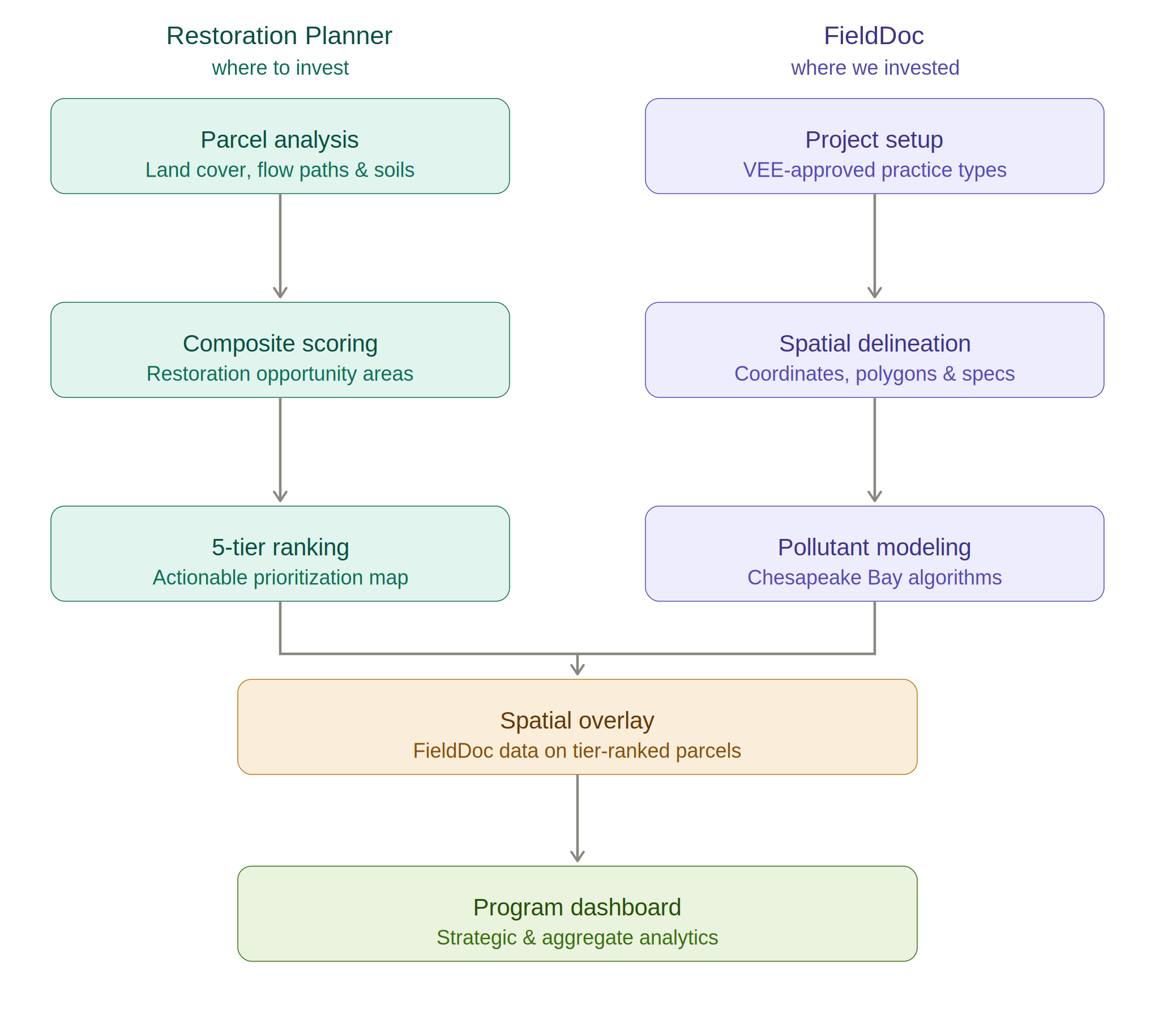
FieldDoc’s implementation tracking provides the “where we actually invested” layer. As grantees deploy conservation practices across the watershed, FieldDoc captures the spatial footprint of each installation—whether a 100-foot riparian buffer segment, a bio-retention cell, or a stream restoration reach—along with its dimensions, specifications, and modeled pollutant reductions. Because each practice is mapped with precise geographic coordinates and polygon boundaries, the FieldDoc data can be directly overlaid onto the Restoration Planner’s tier-ranked parcels. This spatial linkage creates the accountability framework that distinguishes the JRWQIP from conventional grant programs. VEE can now quantify not just how much restoration occurred, but whether that restoration was strategically placed.
Grantee Workflow and Autonomous Reporting
VEE’s program officers worked with The Commons to define the core metrics and practice types relevant to the JRWQIP, establishing a standardized reporting framework within FieldDoc. Grantees enter their information autonomously: they create a project, select restoration practices from the curated list of VEE-approved practice types, and delineate both the location and extent of each practice using FieldDoc’s geospatial drawing tools. The system then uses Chesapeake Bay Watershed Model-derived algorithms to automatically estimate the pollutant reductions resulting from each installation. Grantees can return to their projects at any time to report progress on additional metrics, update implementation status, or refine practice geometries as designs evolve during construction. All individual practice and project data aggregates at the program level, providing VEE with a comprehensive analytical dataset that can be explored within FieldDoc’s dashboards or exported for further analysis.
Results and Outcomes
Since 2018, the JRWQIP has invested over $16 million across the James River watershed, deploying 657 conservation practices tracked through FieldDoc. The program has achieved estimated annual pollutant reductions of 808,700 pounds of nitrogen, 71,800 pounds of phosphorus, and 37.8 million pounds of sediment—load reductions calculated using FieldDoc’s integration of the Chesapeake Bay Program’s Adapted Nutrient and Sediment Load Reduction Model. These outcomes span six primary restoration strategies: riparian buffer installation, agricultural best management practices with enhanced technical assistance, stormwater management in urban and suburban areas, stream restoration with floodplain reconnection, living shoreline construction, and targeted interventions in the Jamestown region.
Demonstrating Return on Conservation Investment Through Spatial Verification
The primary achievement of the JRWQIP’s integrated planning and tracking approach is its demonstration that strategic conservation targeting can be empirically validated at the practice level. By linking each spatially-explicit restoration activity in FieldDoc to its corresponding Restoration Planner tier-ranked parcel, the program has created an unprecedented implementation record that connects planned priorities with verified outcomes. When aggregated across all practice types, 77% of total practice extent is concentrated on Tier 1 parcels—the highest-priority locations—and 95% on the top two tiers combined. While direct comparisons across tiers are nuanced by the mix of measurement units (acres, linear feet, and counts vary by practice type), this overwhelming concentration of implementation in the highest-ranked parcels confirms that the Restoration Planner’s analysis is translating into on-the-ground decisions by grantees, producing the intended alignment between planning data and implementation reality.
This spatial verification capability represents a significant advance for conservation accountability. Where most grant programs can report aggregate pollution reductions, the JRWQIP can demonstrate that those reductions are attributable to strategically-targeted investments in locations independently identified as having the highest restoration potential. The tier distribution data provides VEE’s Board of Directors, stakeholders, and the broader conservation community with empirical confidence that the $15.595 million endowment is generating verifiable, location-specific water quality improvements concentrated in the places where the science indicates they will deliver the greatest environmental return.
Creating a Replicable Model for Funder-Level Conservation Accountability
The JRWQIP’s integration of the Restoration Planner and FieldDoc establishes a replicable model for any conservation funder seeking to link investment targeting with implementation verification. The approach demonstrates that when planning data and tracking data share a common spatial framework, funders can move beyond aggregate reporting to answer the fundamental question of whether their investments are landing where the science says they should. This closed-loop accountability system—from parcel-level prioritization through practice-level tracking to spatial validation—provides a template for other watershed-scale conservation programs seeking to maximize and verify the impact of their investments.
The JRWQIP model also validates the power of collaborative infrastructure: the Chesapeake Conservancy’s high-resolution geospatial expertise provided the targeting intelligence, The Commons’ FieldDoc platform provided the tracking and measurement infrastructure, and VEE’s program leadership provided the investment strategy that connected planning with action. Together, these organizations demonstrate that the combination of precision conservation data, practice-level implementation tracking, and strategic grant management can produce outcomes that are not only environmentally significant but empirically verifiable—setting a new standard for accountability in conservation investment.
Empowering Grantees and Building Technical Capacity
Beyond its role in program-level accountability, FieldDoc has served as a capacity-building tool for the diverse network of restoration practitioners working across the James River watershed. Organizations ranging from the James River Association’s large-scale riparian buffer collaborative to local soil and water conservation districts and land trusts use FieldDoc to manage their project data, map their installations, and generate the pollutant reduction estimates required for VEE reporting. The platform’s autonomous reporting workflow enables these organizations to enter and manage their data independently, building internal technical capacity while maintaining the standardized data quality that the program requires. As grantees become more proficient in geospatial data management through their FieldDoc use, they carry those skills into other programs and partnerships—amplifying the JRWQIP’s impact beyond its direct investments.
Support the Digital Services Program
.svg)

.svg)